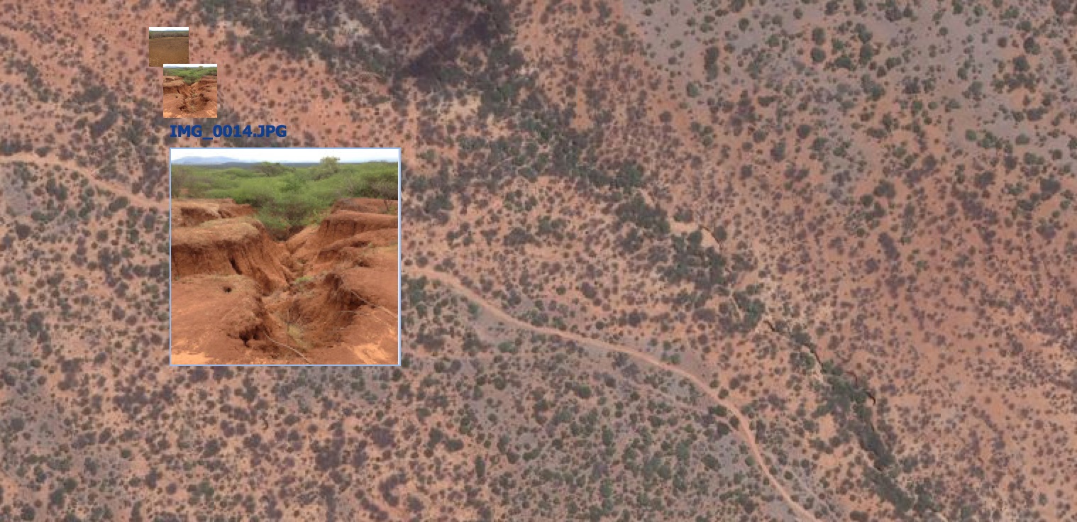
Adding geotagged photos to your map can be a powerful way to visualize the landscape that you are mapping, or even as a way to validate your mapping outputs. In the Landscapes Portal you can do this in three simple steps when creating a new map or when editing one of the existing maps on ...
You are using an outdated browser that is not supported by GeoNode.
Please use a modern browser like Mozilla Firefox, Google Chrome or Safari.
Tag archives: landscapeportal
Add geotagged photos to your map
Written by Tor-G. Vagen on May 8, 2014 in New maps.
Last update on May 8, 2014.
Tags : landscapeportal
Short url : http://landscapeportal.org/blog/12/
Discussions : No comments yet. Be first to comment!
Landscapeportal Workshop @ ICRAF
Written by eopiyo on March 7, 2014 in Training, Workshop.
Last update on March 12, 2014.
The GeoScience Lab has the pleasure of inviting you to a one day workshop on how to use the Landscapes Portal to share, download, visualize and analyse spatial data, scheduled for 12 March 2014 from 10:00am EAT time at the Lundgren Auditorium, World Agroforestry Centre. This is a follow up to the seminar done ...
Tags : landscapeportal training workshop
Short url : http://landscapeportal.org/blog/9/
Discussions : No comments yet. Be first to comment!
Welcome
The Landscapes Portal blog is where you can share ideas and experiences on landscape level applications of GeoScience, as well as modeling and mapping in general.
Please do not hesitate to send us suggestions and/or requests for functionality also.
Recent Entries
- Farmer-managed natural regeneration as a land restoration strategy. Under what conditions does it work?
- Regreening Africa App and Data Reporting System (DRS) Trainings
- Data visualization with ggplot2 for intermediate and advanced users
- Introduction to data visualization with ggplot2
- Data manipulation in R
Categories
- Biodiversity 10 entries
- Deforestation 6 entries
- GIS 5 entries
- Land Degradation 10 entries
- New maps 4 entries
- R 23 entries
- Software 11 entries
- Soil Mapping 7 entries
- Training 16 entries
- Workshop 7 entries
Authors
- s.palmas 1 entry
- tor2 1 entry
- Tor-G. Vagen 26 entries
- eopiyo 5 entries
- PMakui 1 entry
- faith 5 entries
- Leigh Winowiecki 1 entry
- admin 15 entries
- aida.bargues.tobella 2 entries
- madelonlohbeck 3 entries
- JWanjara 2 entries
- jaysnm 1 entry
- muhammad 4 entries
Tags
- Aerial
- Africa
- agroforestry
- Android
- capacity building
- data analysis
- Data Manipulation
- deforestation
- DRS
- Examples
- FLR
- gdal
- ggplot
- ggplot2
- gis
- ICRAF_useR
- images
- land
- landscapeportal
- Landscapes
- LDSF
- Machine Learning
- monitoring
- Portal
- Project
- R
- Regreening
- Reproducibility
- resoration
- restoration
- R programming
- seminars
- sentinel landscapes
- software
- soil infiltration capacity
- statistics
- training
- water
- workshop
Recent Comments
- No comments yet.
Random Entries
Popular Entries
- No entries yet.
2024 © World Agroforestry Centre | Powered by GeoNode version 2.4.1 | Help | About