Archives May 2014

Mapping the source of soil erosion

Last update on May 21, 2014.

Mapping the source of soil erosion

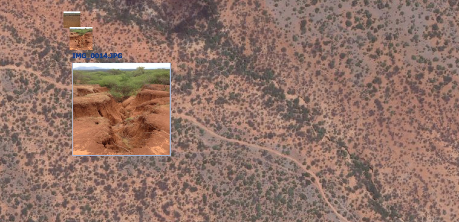
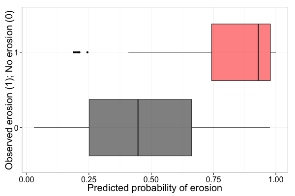
Predicting soil erosion

Conventional soil erosion models are generally based on the Universal Soil Loss Equation (USLE), or a revised (RUSLE) or modified (Williams and Berndt (1977)) version of the USLE. Betrie et al (2011) used the Soil and Water Assessment Tool (SWAT), which uses MUSLE to compute soil erosion, to model sediment transport in ...

Continue reading

Add geotagged photos to your map

Last update on May 8, 2014.

Add geotagged photos to your map

Adding geotagged photos to your map can be a powerful way to visualize the landscape that you are mapping, or even as a way to validate your mapping outputs. In the Landscapes Portal you can do this in three simple steps when creating a new map or when editing one of the existing maps on ...

Continue reading

Daily archives

Previous month

April 2014

Next month

June 2014

Archives