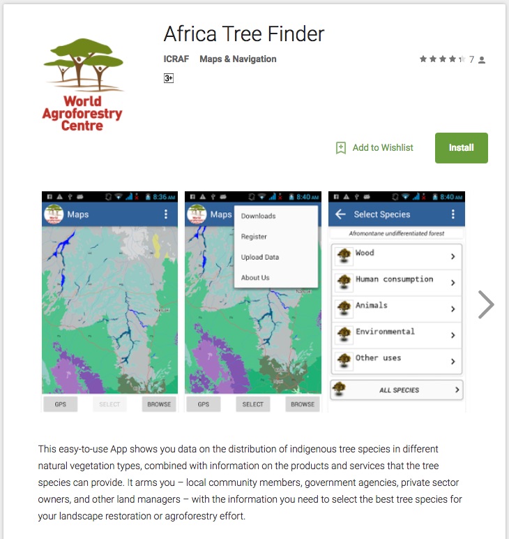
A new version of the Africa Tree Finder is on the Google Play store with lots of improvements and new functionality. Have a look here: https://play.google.com/store/apps/details?id=com.icraf.gsl.africatreefinder&hl=en
Category archives: GIS
New version of Africa Tree Finder on the Google Play Store
Written by on Nov. 7, 2017 in Biodiversity, GIS, Software.
Last update on Nov. 7, 2017.
Community resource mapping and visioning in Hurri hills and Shurr landscapes
Written by on March 30, 2017 in GIS, Workshop.
Last update on March 30, 2017.
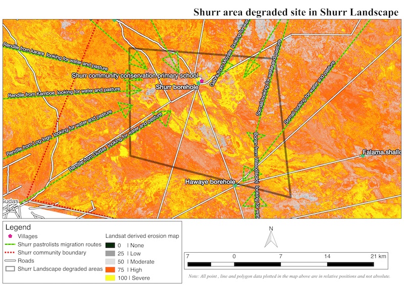
A community best understands its resources, the specific locations and seasonal variations of grazing resources. It is with this knowledge that the GeoScience Lab in collaboration with International Union for Conservation of Nature (IUCN), planned and executed a community-based resource mapping exercise for Hurri hills and Shurr landscapes in Marsabit County. Historically, both landscapes were ...
ICRAF GeoScience Lab launches new Android App - Africa Tree Finder
Written by on Oct. 13, 2015 in GIS, Software.
Last update on Nov. 23, 2015.
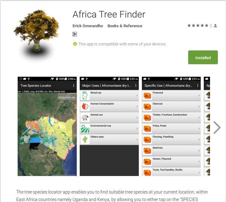
ICRAF Geoscience Lab in partnership with IUCN with funding by DFID have developed a semi offline android [app](https://play.google.com/store/apps/details?id=org.icraf.gsl.iucn.treespecieslocator "Africa Tree Finder"), that can be used by extension officers, foresters, ecologist and farmers to help identify suitable tree species for their surrounding. The ...
Aerial images from Kenya georeferenced by the ICRAF GeoScience Lab
Written by , on Feb. 11, 2015 in GIS, Software.
Last update on Feb. 11, 2015.
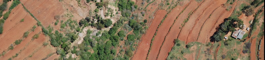
During the "Kenya Landuse Change" project conducted by the Climate Change Unit at ICRAF, several thousand aerial images were collected from surveys done in 1983 and 2012, respectively. During the last three months, the ICRAF GeoScience Lab has georeferenced this image archive to an accuracy of ~5m or better, with the help of six interns ...
Usage statistics for the Landscapes Portal
Written by on June 4, 2014 in GIS, New maps.
Last update on June 26, 2014.
The Landscapes Portal is growing rapidly. Into our fourth month, the Landscapes Portal has around five hundred unique data sets with complete meta-data and more than two hundred registered users that are uploading and sharing spatial data and maps. We saw a lot of interest in the last two months with more than four thousand ...